I’ve been learning how to use GIS tools for spatial data analysis. I found it very interesting and is helping me to expand my knowledge about different types of data analysis. Here I’d like to share some of what I’ve been developing 🗺️
GIS for Solar
In 2025 I was accepted into the Relay GIS Mapping for Solar Course, a 13-week program to learn how to use Geographic Information Systems mapping for solar energy projects.
Some of the projects that I’ve developed during the program are:
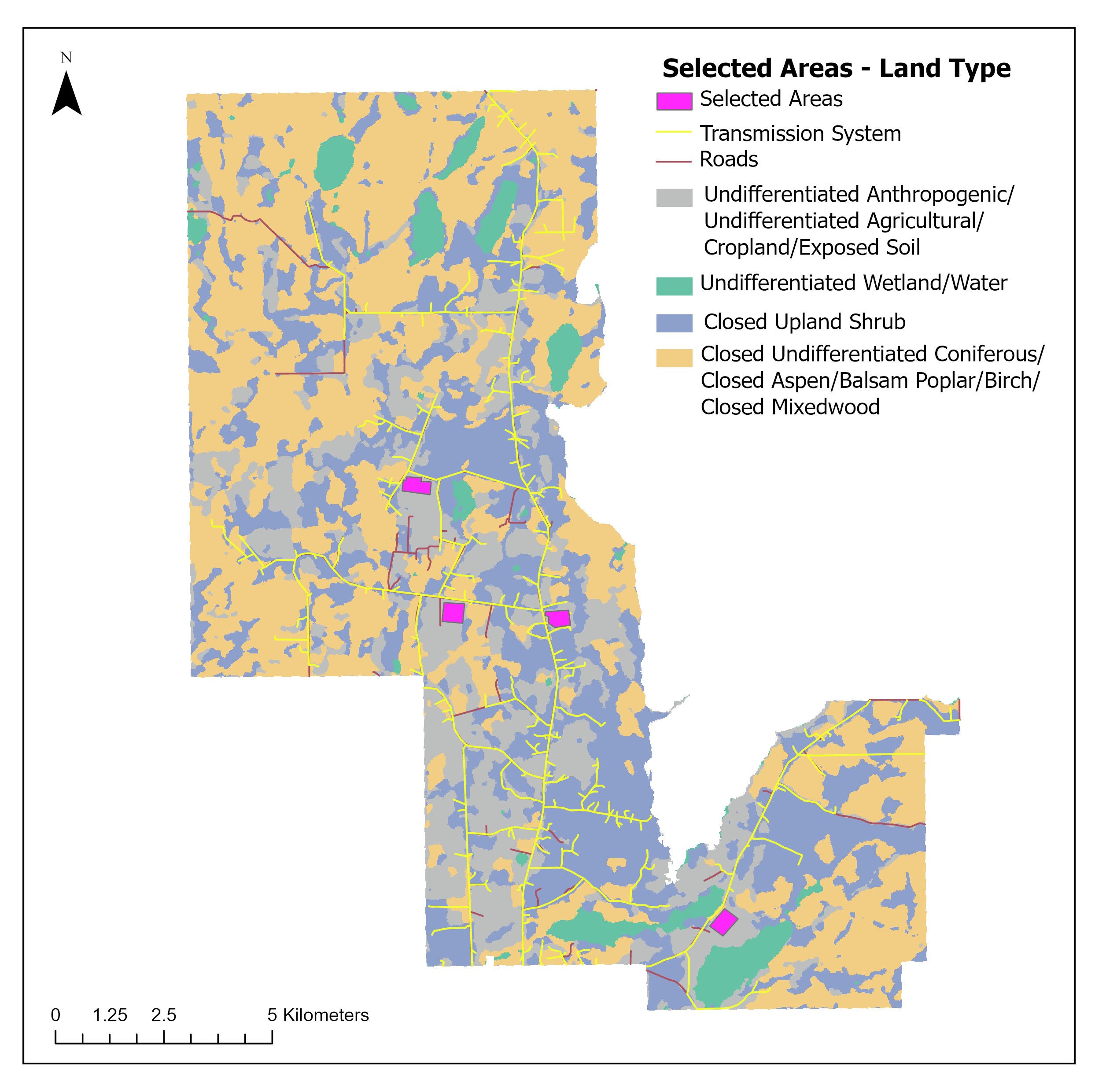
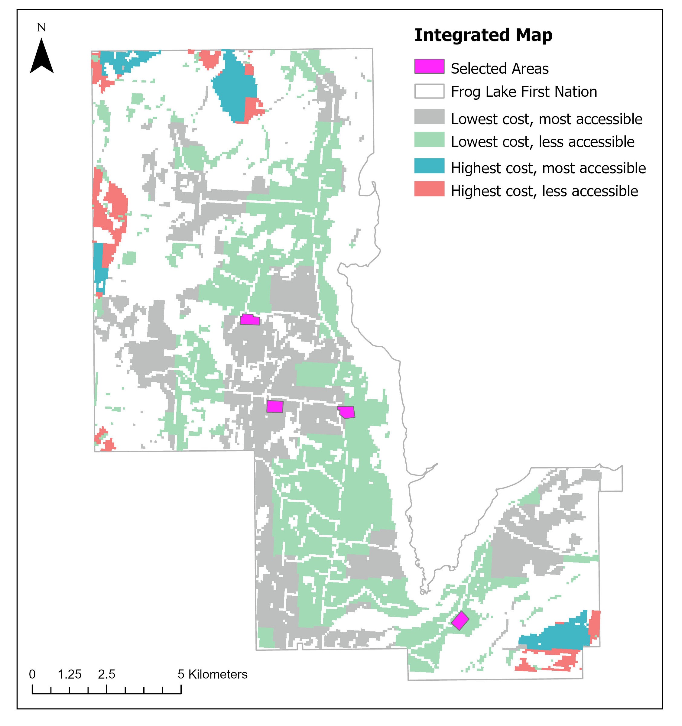
- Mapping Opportunities for a Solar Farm in Frog Lake First Nation: In this project I analysed different map layers to map better opportunities for solar farms in the area of Frog Lake, AB. The idea was to analyse technical and economical potential, togheter with regulatory constraints, in order to understand what would be the best areas.
-
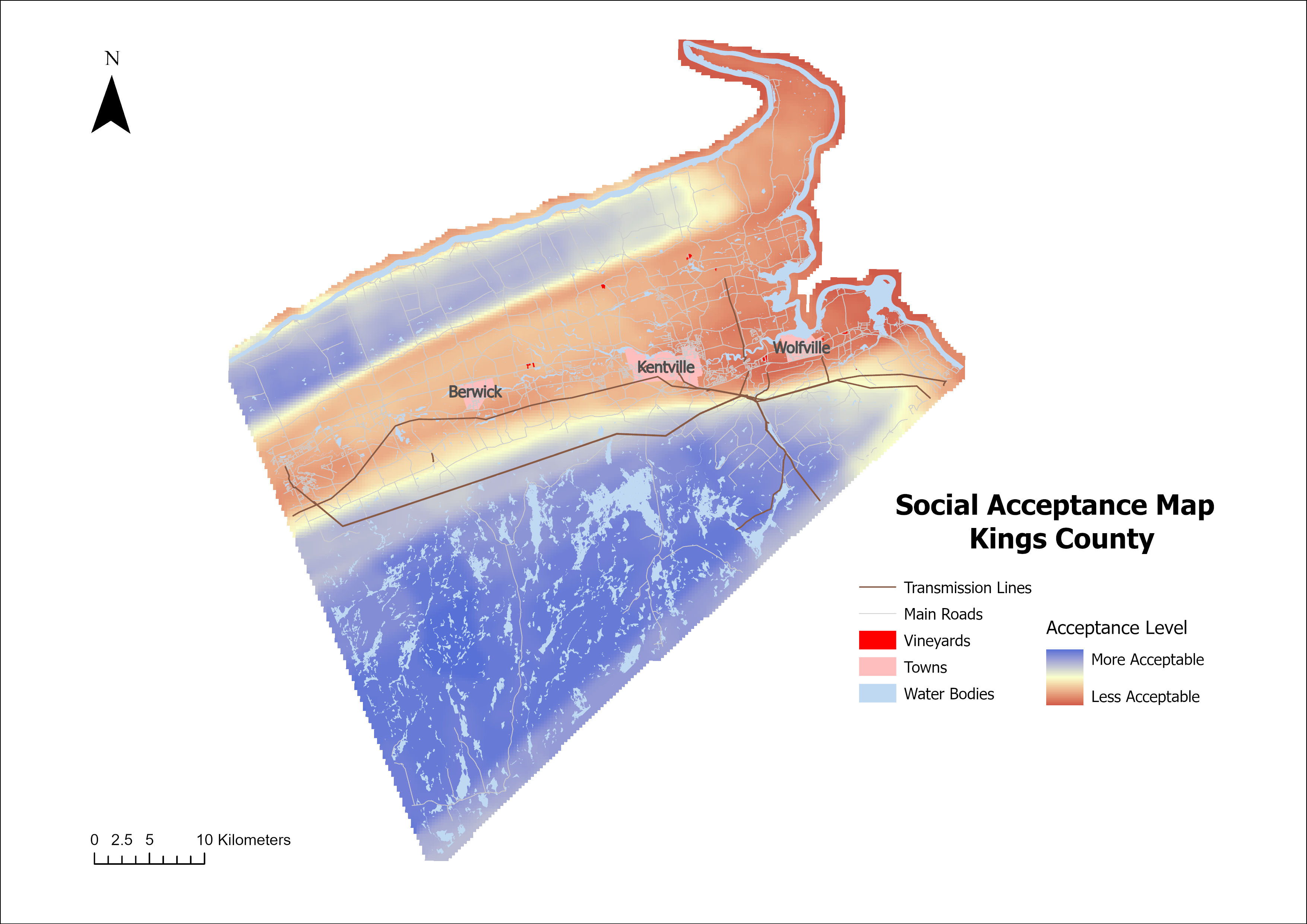
Mapping Opportunities for Solar Energy Development in Kings County: The goal of this project was to create a Story Map to showcase results of participatory mapping, helping to leverage community engagement in the field of Solar Energy Development. To do that I processed the spatial data using ArcPro, and analysed participants survey results to have insights of the more suitabe places for solar development. I used excel to process the data and to create the charts.
-
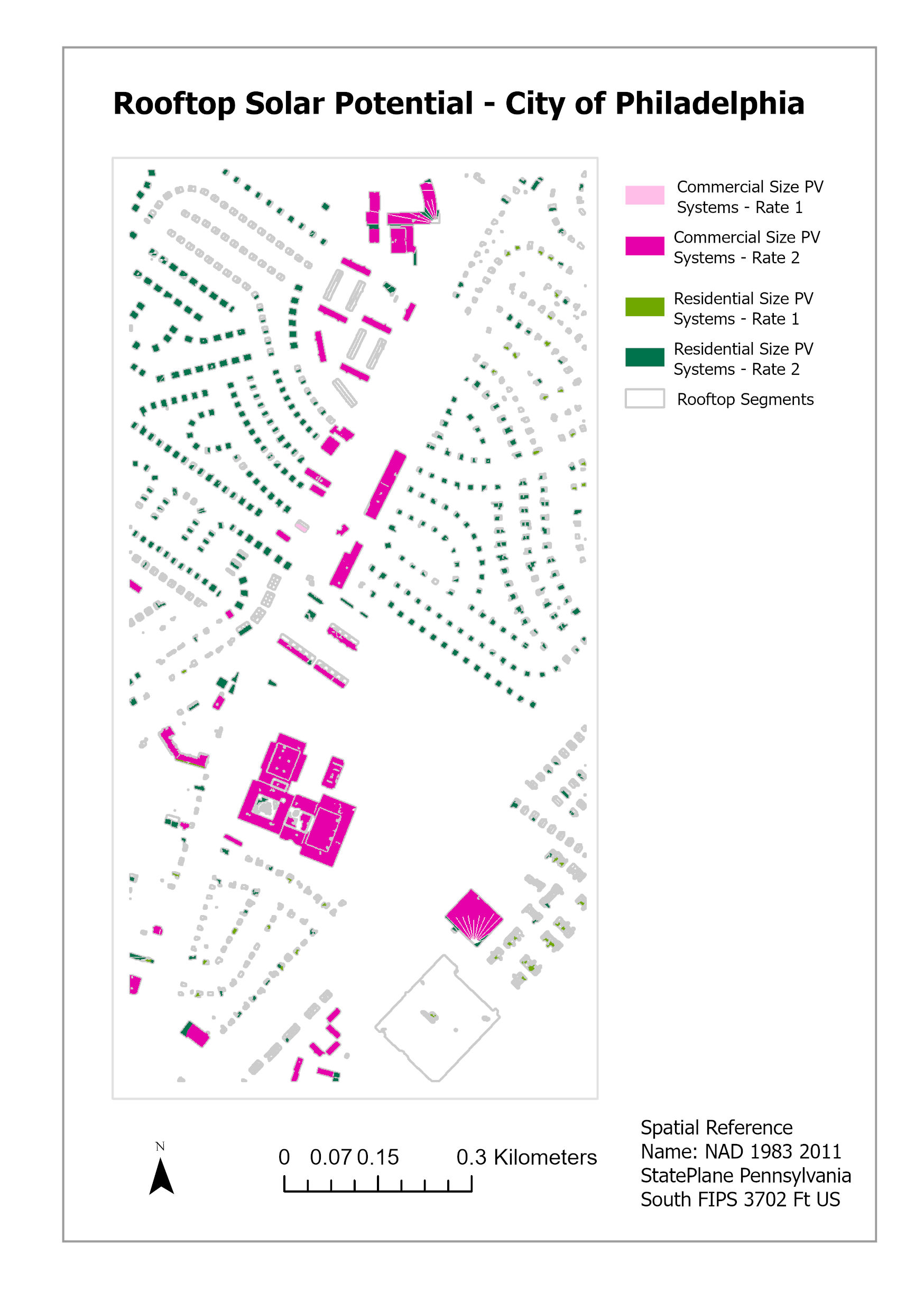
Identifying Suitable Rooftops for Photovoltaic (PV) Systems City of Philadelphia Using data from a small part of the city of Philadelphia to identify suitable rooftops for PV systems.
Other GIS Projects
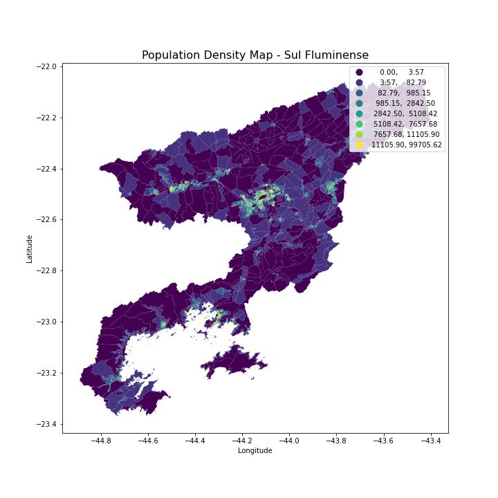
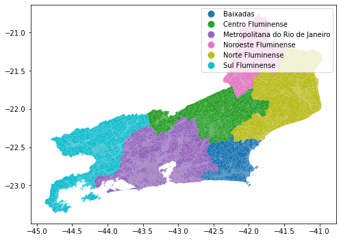
- Creating maps with python and geopandas: Here I’ve created a map of Rio de Janeiro state with its 6 sub-regions and a population density map of the sub-region called Sul Fluminense (where I am originally from!). The data comes from IBGE (Brazilian Institute of Geography and Statistics) and are part of the 2022 census.